
Part six of a nine-part series on the proposed town green on Railroad Avenue.
Since the 1990s the Atlanta Regional Commission (ARC) and others across metro Atlanta have been focused on getting people out of their cars and walking. This has often required retrofitting suburbia with new sidewalks, trails, and rethinking outdoor spaces and how we connect. Tucker’s street and alley grid created in 1892, uniquely positioned Downtown Tucker to have the best of both worlds. A town center that is pedestrian friendly and can also remain auto friendly. This would be a far more difficult and expensive endeavor were it not for the alley network.
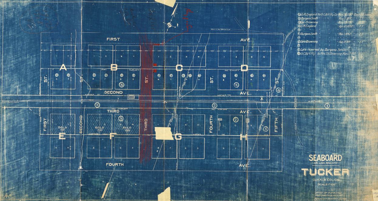
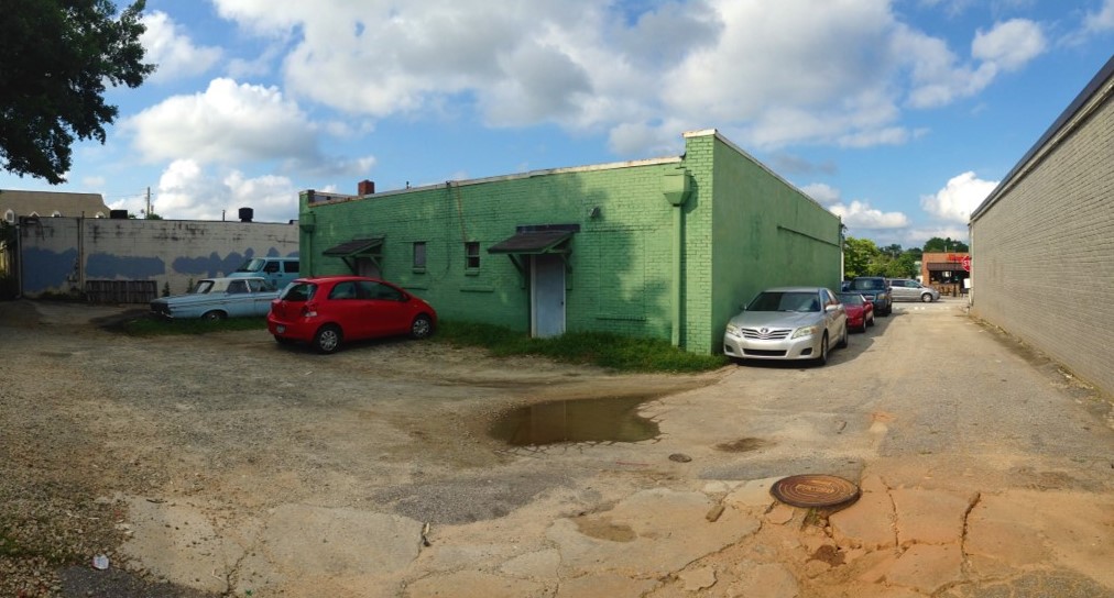
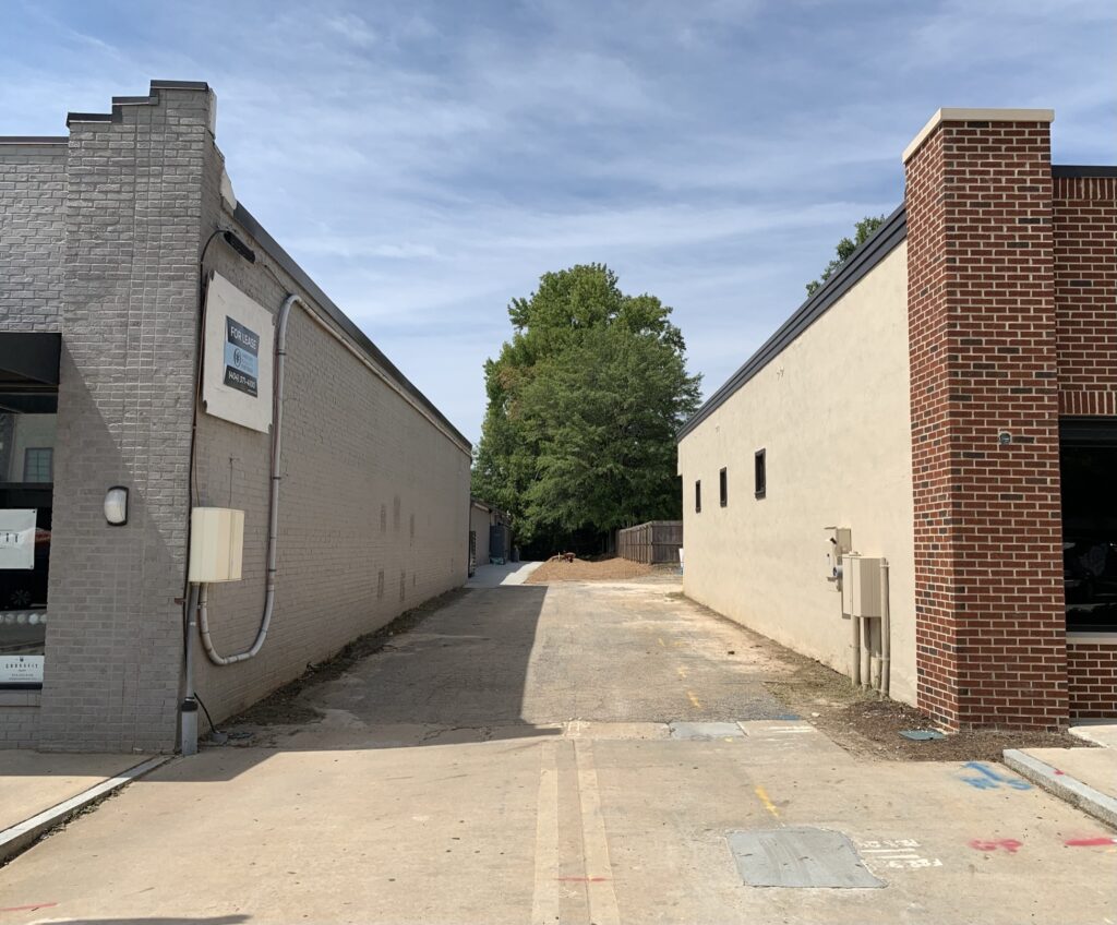
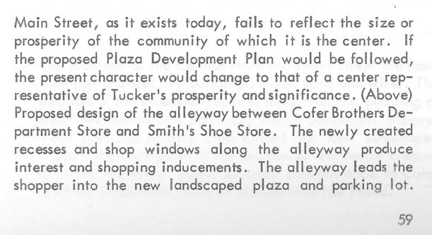
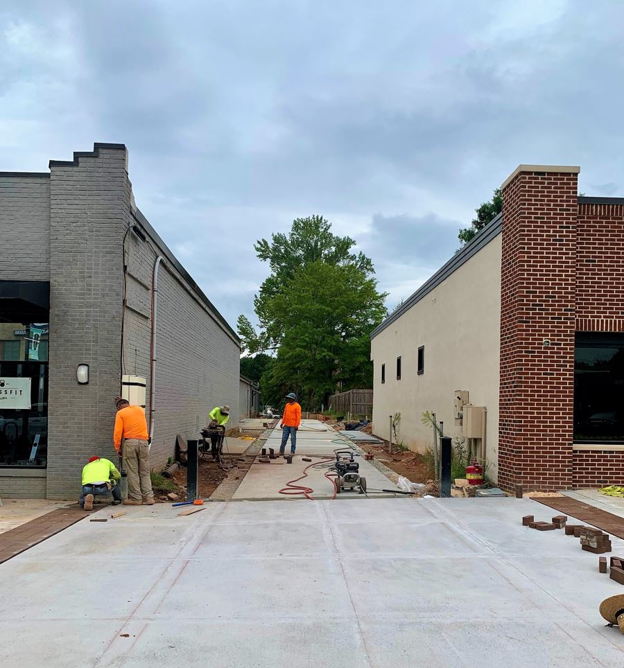
The original plan for Tucker began with eight blocks, lettered A through H, along the railroad tracks. Block A was divided in half by a 20-foot-wide alley. The remaining seven blocks were divided into quarters by 20-foot-wide alleys running north and south. Today the City of Tucker is converting the alleys west of Main Street into pedestrian friendly spaces. What was once the back or side of a building can now have the same benefits as the front. This creates an opportunity for more store fronts, outdoor dining, and gathering places away from the street. All of it leading to the town green.
Where did this idea of using the alleys come from and how did it gain public support? This century, using the alleys for pedestrians was first mentioned in the Tucker Livable Centers Initiative (LCI) in 2005. The idea faded into obscurity until the Tucker-Northlake CID began studying the existing right of way, to identify land use opportunities, over a year prior to working on the Downtown Tucker Master Plan.
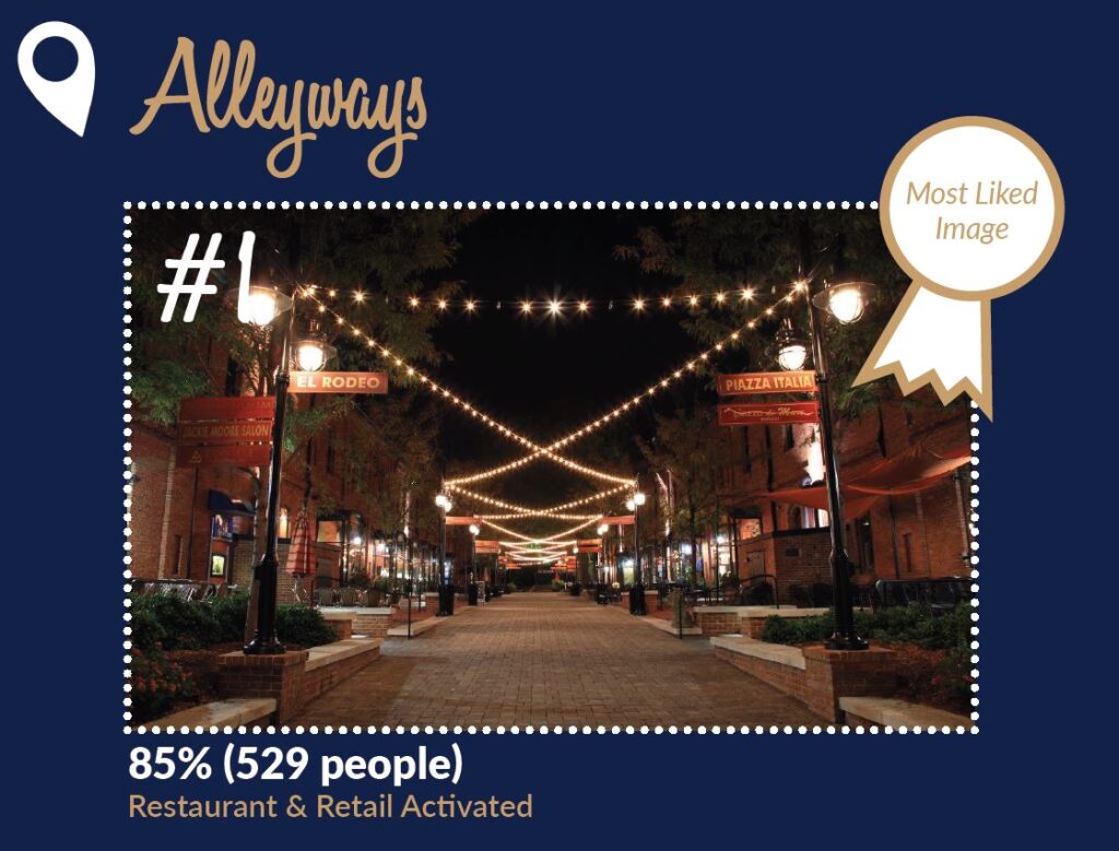
As part of the Downtown Tucker Master Plan in 2019, TSW conducted a survey that included responses from 621 people. What did people prefer? The most liked image in the survey was one of Brightleaf Square in Durham, North Carolina.


TSW also presented two concepts for Downtown Tucker, and each included green space on Railroad Avenue and opportunities for alleys expansion.

What could these spaces look and feel like? Following the completion of the Downtown Master Plan, the Tucker-Northlake CID received a grant from the ARC to work with Lord Aeck Sargent and Alta Planning + Design on a Downtown Tucker Grid Plan, and again with the Urban Land Institute on an Alley Activation Study, to answer those important questions.
The study of the alleys and streets went back to 1891, tracing the sales of private property and the movement of right of way for nearly 130 years. It was an unpresented effort and included collections held by the Tucker Historical Society and records obtained from the DeKalb County Records Room at the courthouse in Decatur. To ensure the work was not lost, in addition to the plan, Lord Aeck Sargent compiled an appendix (325 Mb) containing scores of primary documents, photographs, and other information.
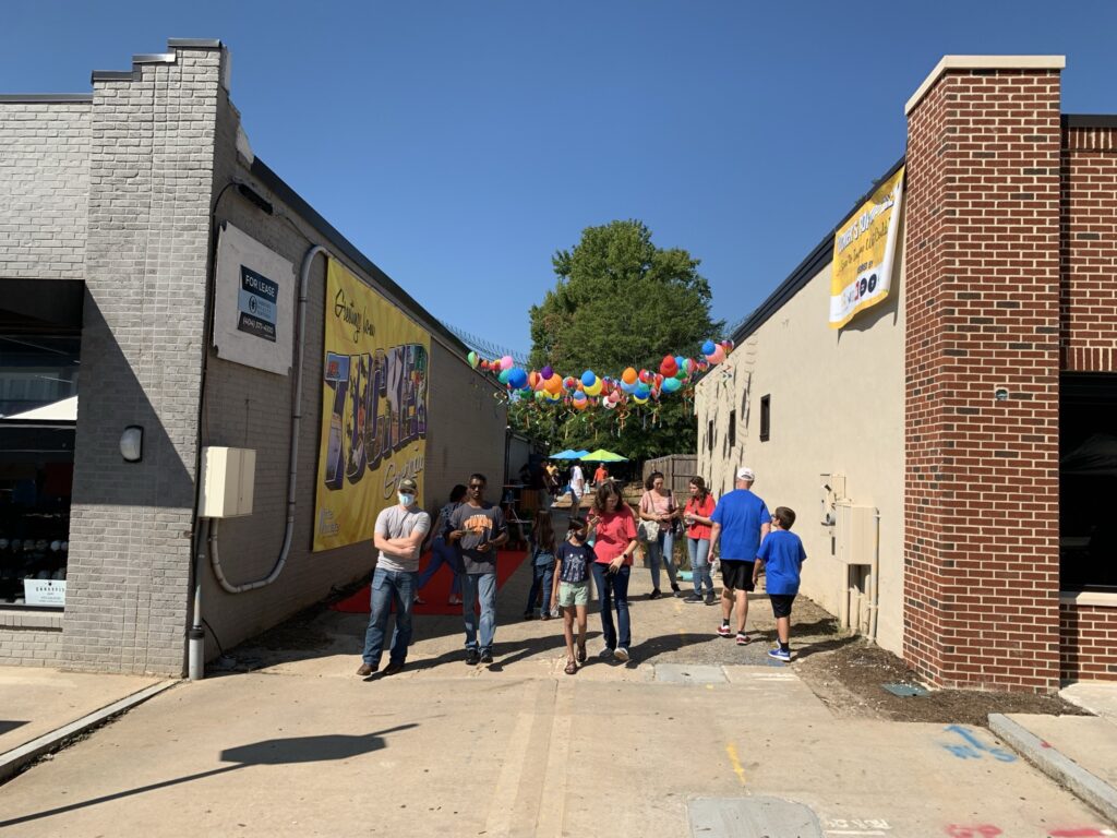
Due to the pandemic the public engagement portion of the Downtown Tucker Grid Plan was delayed until Tucker Day 2021. The timing worked out for the “popup alley” event to coincide with our partnership with the City of Tucker, and the ARC, to explore the opportunity for art in the alleys. The temporary popup alley included examples of street furniture, landscaping, and public art.
These efforts confirmed what was already known. Investing in Tucker’s alleys makes sense. When the environment is right, people will naturally fill spaces away from the street. Making the alleys clean, safe, and attractive will continue to draw investment as businesses begin to see opportunities just around the corner.

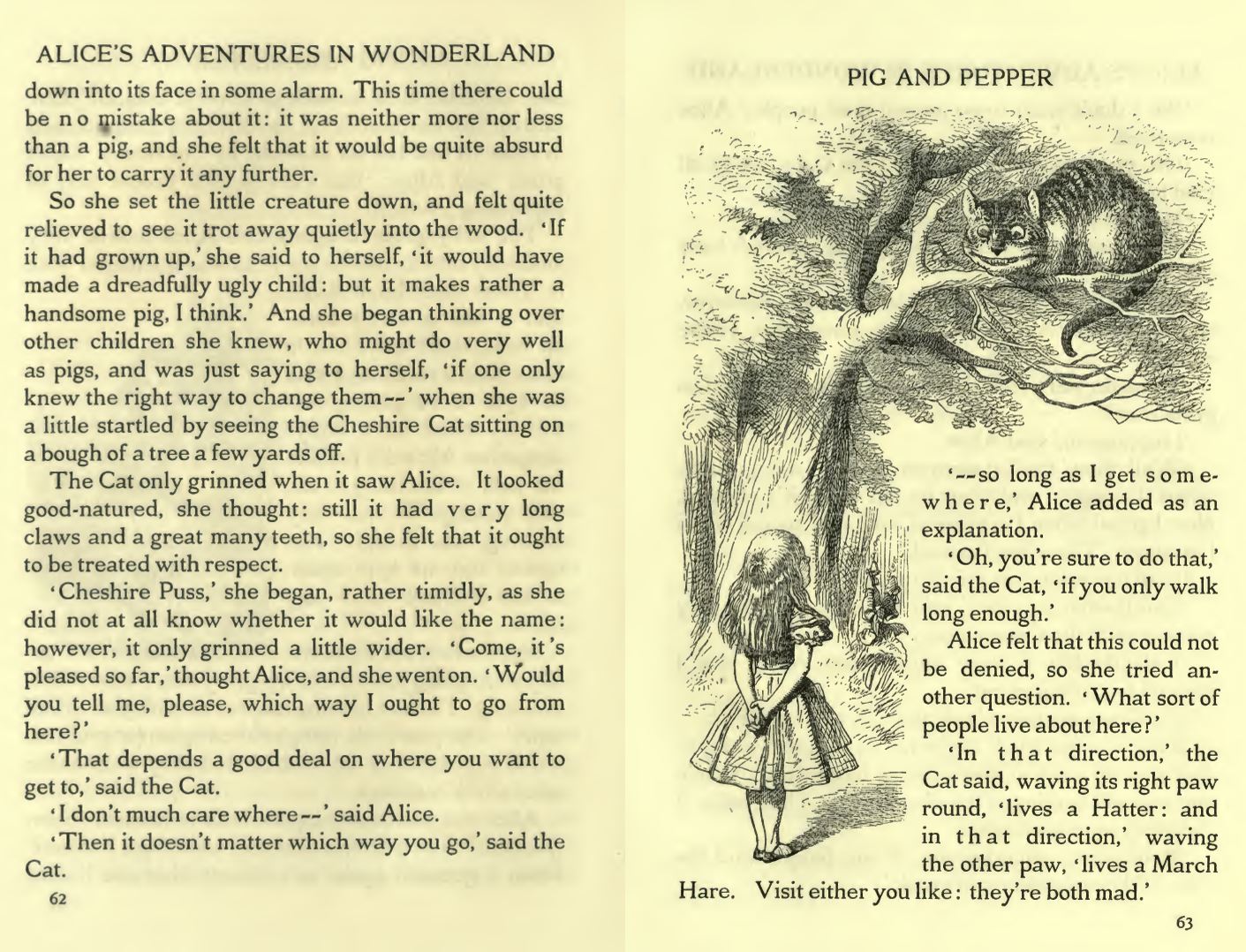
How much investment depends on the destination. Where is the destination? The wisdom of the Cheshire Cat from Alice’s Adventures in Wonderland applies. If you don’t know where you’re going, any road will take you there.
Today we understand that the destination is experienced in the journey. When you step on the BeltLine in Atlanta, you have arrived. It will be the same with the trail network and the alleys. Like Truist Park, home of the Braves, the experience begins long before you take your seat.
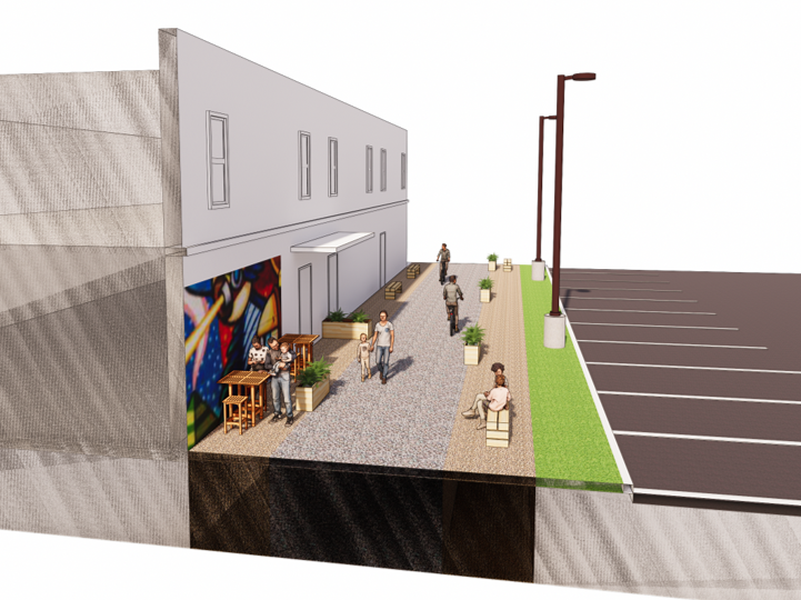
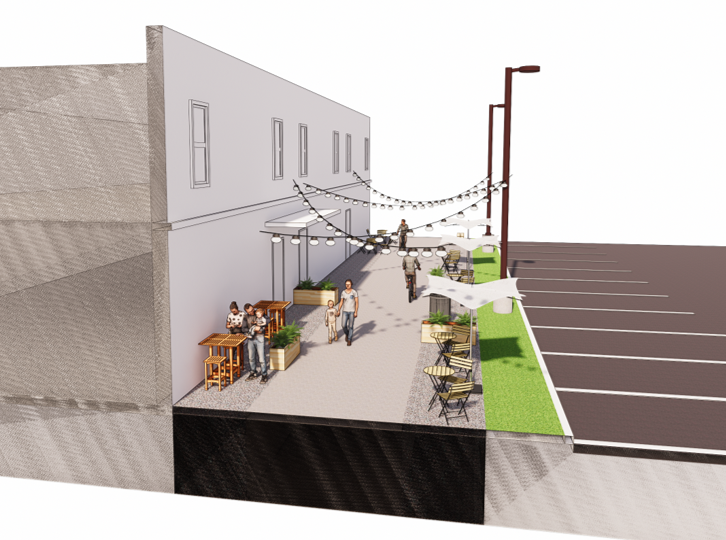
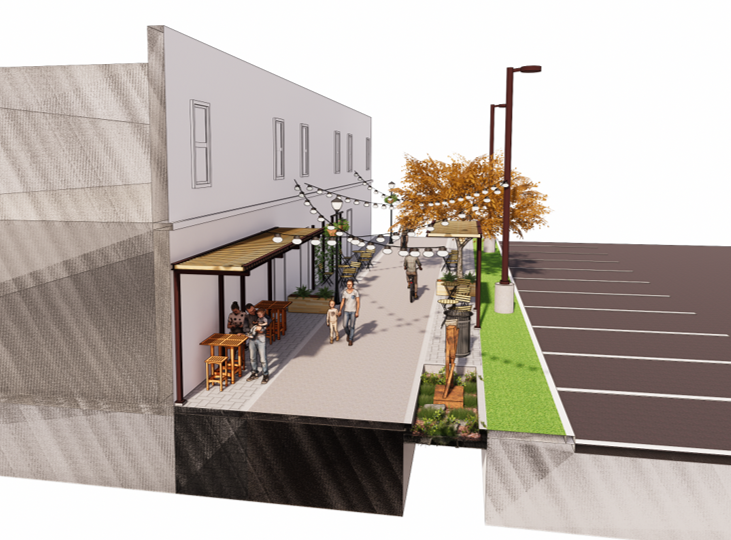
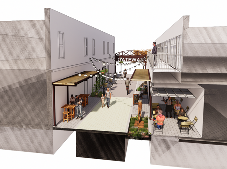
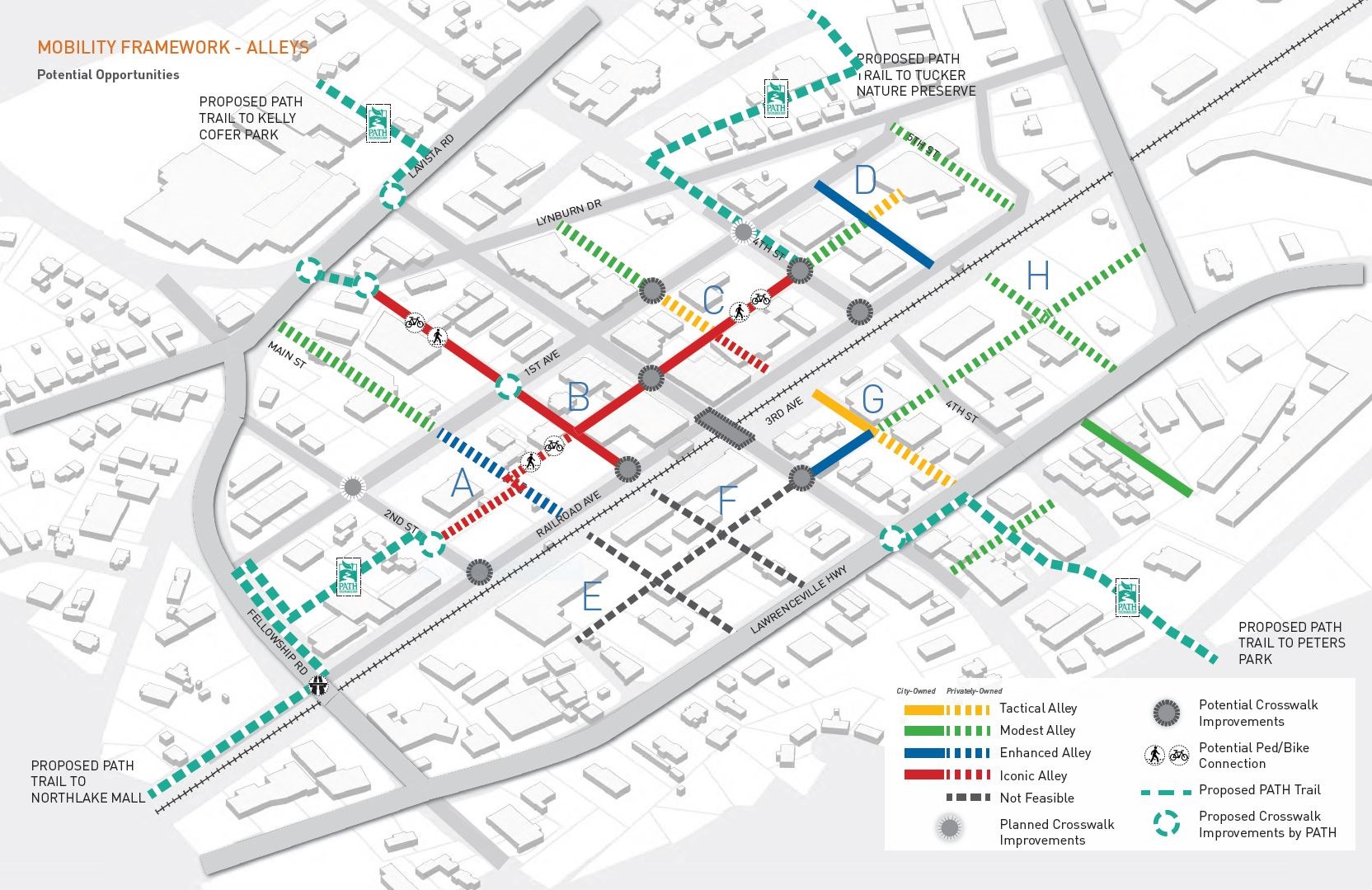
Out of the four alley typologies considered in the Grid Plan, the highest level of investment appealed to everyone involved. One that would be a balance of new and infill development on existing blocks, with fully integrated alley improvements for commercial use.
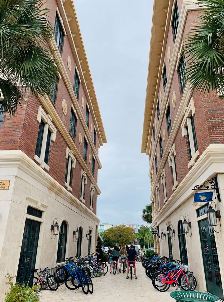
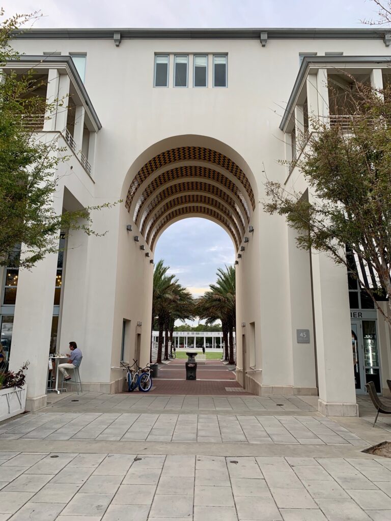
A review of the alleys, court yards, and plazas in the highly walkable communities along 30A on the gulf coast of Florida give one a sense of the opportunities surrounding Tucker’s alleys. No one beats Florida in terms of flat, but the relatively flat terrain in Tucker adjacent to the railroad tracks creates ideal conditions for biking and walking.
The nearly one mile of 20-feet wide alleys created in 1892 present multiple opportunities for developing inviting spaces. The city code in Downtown Tucker includes height restrictions supporting designs that maintain a scale where those above the street are still close enough to feel connected to it.
Today the City of Tucker is laying the foundation for an iconic look in the alleys with brick work that will match Main Street and lighting that will match the lighting on First Avenue. The west side of Main Street will be an ideal location for commercial property owners to view the space around them with new eyes.

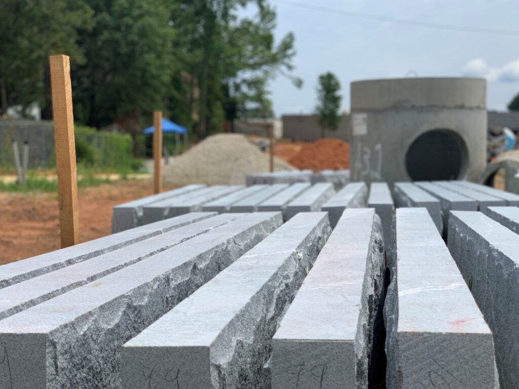
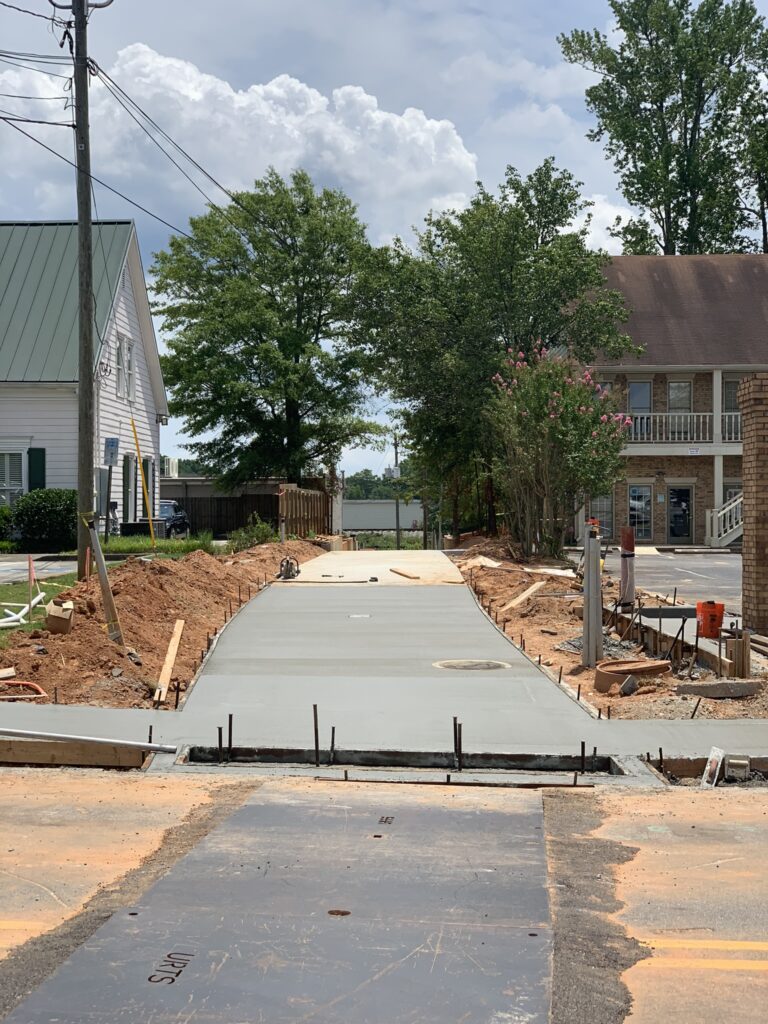
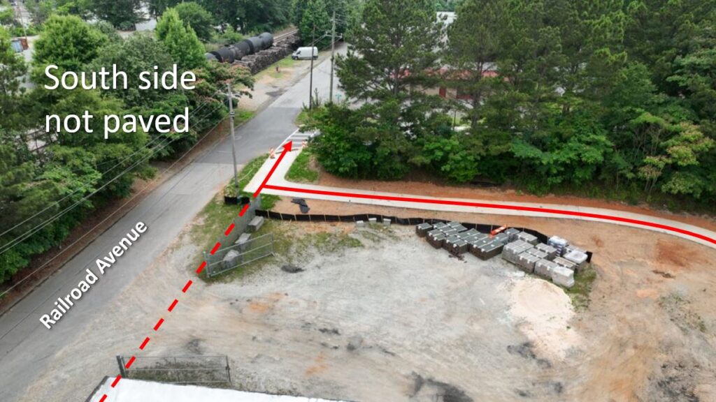
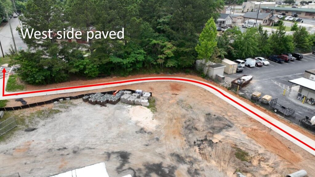
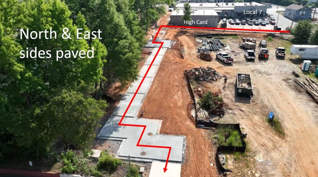
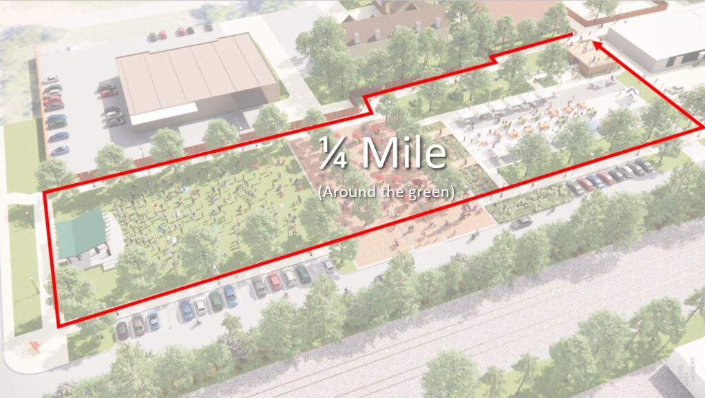
Beyond the commercial and social opportunities created by the alleys leading to the future Tucker Town Green, there is ample opportunity for walking and connection on the property. Three of the four sides of the property are already paved due to the city’s implementation of the trail project through the alleys. This creates an opportunity for the path to encircle the property by paving the south side. Doing so would create a 1/4-mile walking track around the property.
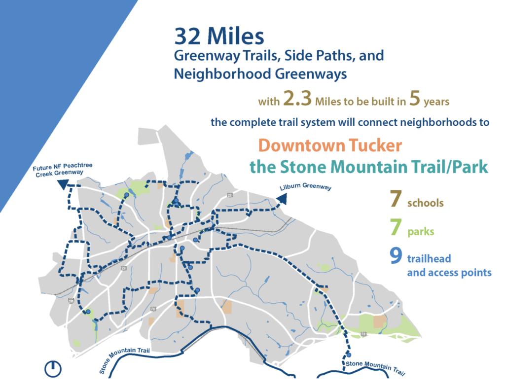
One of the most important connections to the town green will be the trail extending from Downtown Tucker all the way to Northlake Pkwy inside the Perimeter. In the fall of 2021, the City of Tucker secured a trail grant from the ARC to help fund scoping and engineering for the project.
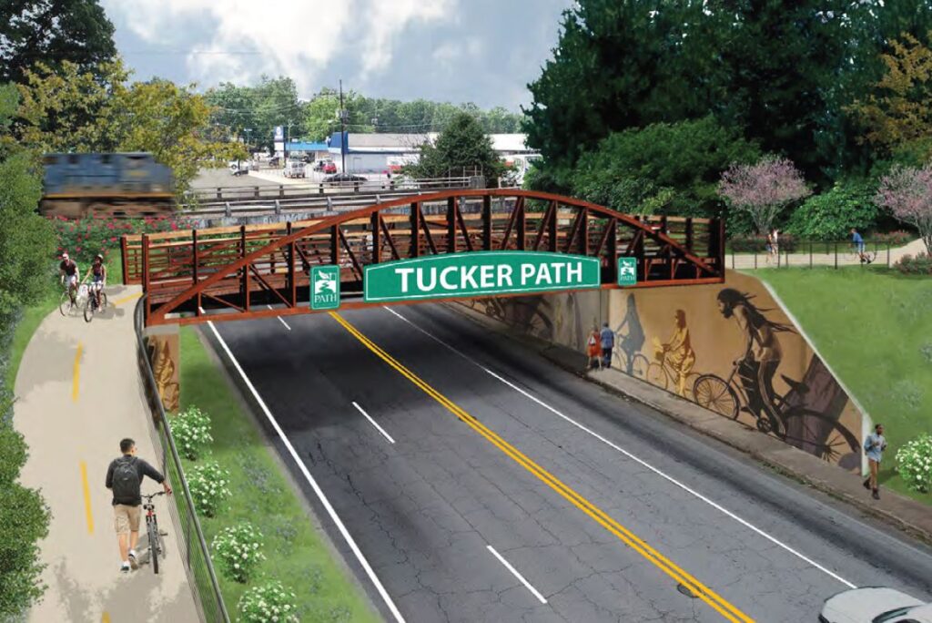
As part of this roughly three-mile section of trail, when completed, the Railroad Avenue bridge across Fellowship Road will restore the pedestrian connection that was lost when the underpass was created in 1984. Closing this gap will make the downtown core more accessible for thousands of residents.
With a master plan for 32-miles of trails eventually flowing into the town green, commercial opportunities along the alleys, and the opportunity for a 1/4 mile path around the property, Downtown Tucker will be a leader in walkability. All of it can be done without undermining the existing road network or putting pedestrians in harm’s way.
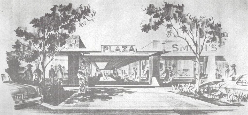
While all of these ideas may feel new, the general concepts of more effective use of space and connections in Tucker have been around for a while and the old saying is true; if you want a new idea, read an old book. That’s certainly the case with the development of alleys in Downtown Tucker and even the idea of a town green on Railroad Avenue. Not only do alleys appear in the Tucker LCI study in 2005, a plan published in 1964 reads like it could have been written today.
The Tucker-Northlake CID looks forward to the fulfillment of a collective vision spread across decades of planning efforts, to make Downtown Tucker one of the most walkable, accessible, and enjoyable places in the state.
[Please note that the images on this site related to the town green are for discussion purposes only. A final design has not been selected by the City Council. The Council is expected to make a decision on implementation later this year following the inclusion of additional public input and recommendations from Barge Design Solutions.]